Over 20 years online have taught us something: quotes are needed fast. That's why we deliver a proposal within 1 hour. Use our service forms for best results.
Sensors & Software® is a registered trademark of Sensors & Software Inc. (Radiodetection).
Using a Noggin, LMX or pulseEKKO and need help with interpretation? At Cartomex, we know Sensors & Software equipment better than most — in fact, our very first GPR project used a Noggin. More than 20 years later, we still process data from this platform with the same passion and much more experience.
Sensors & Software (now part of Radiodetection) is one of the world's most respected GPR brands, recognized for exceptional data quality and platform versatility. If you have .dt1 files that need to be turned into actionable information, you're in the right place.
Real Example: Before and After Processing
Here's how we transform raw Sensors & Software data into interpretable information:
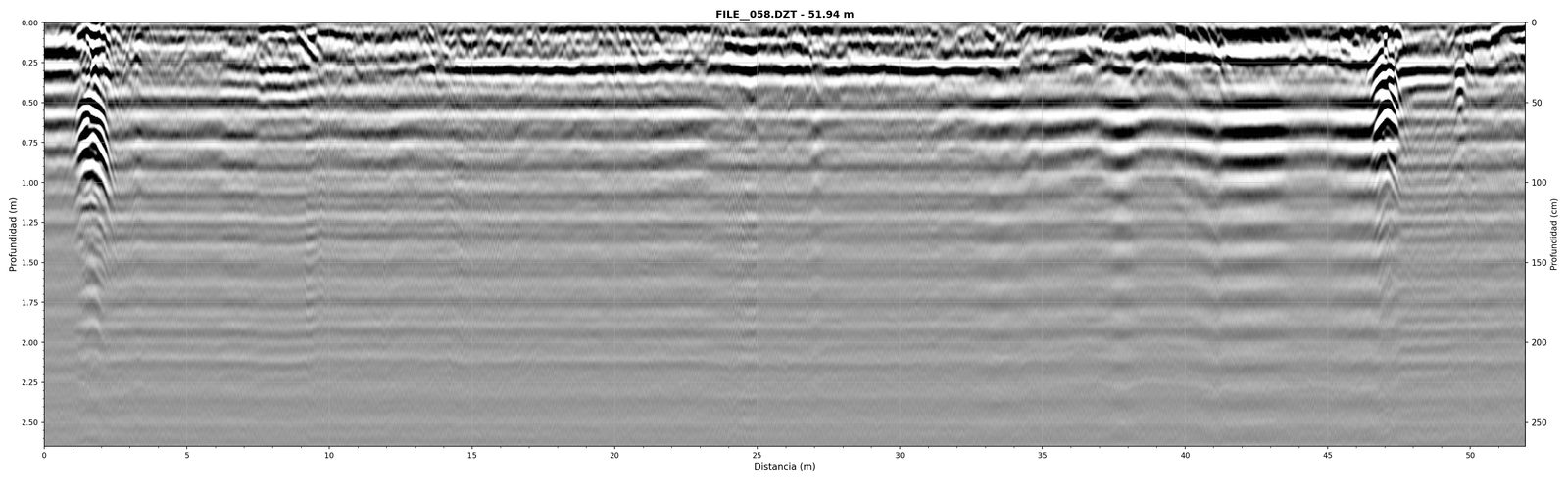
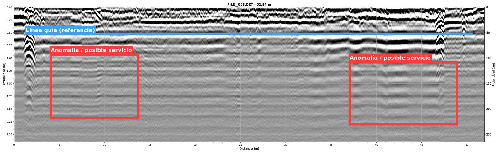
Data acquired with Noggin 250. Left: unprocessed .dt1 file. Right: processed radargram with geophysical interpretation. © Cartomex.
Sensors & Software Systems We Process
| System | Available Frequencies | Format |
|---|---|---|
| LMX200 / LMX200-SG | 250 MHz (UWB with DynaT) | .dt1 / .hd / .GPZ |
| LMX100 / LMX150 FINDAR | 250 MHz (UWB) | .dt1 / .hd |
| Noggin SmartCart | 100, 250, 500, 1000 MHz | .dt1 / .hd |
| pulseEKKO Pro / Ultra | 12.5 – 1000 MHz (configurable) | .dt1 / .hd |
| Conquest | Integrated dual frequency | .dt1 / .hd |
| SPIDAR (multi-channel) | Multiple simultaneous channels | .dt1 / .hd (multi-channel) |
| Radiodetection RD1500 / RD1100 | UWB with FrequenSee | .dt1 / .hd / .GPZ |
Important note: Radiodetection equipment (RD1500, RD1100, LMX100, LMX150, LMX200) uses Sensors & Software technology and file formats. If you own any of these systems, our processing service is fully compatible.
Our Experience with Sensors & Software
Our relationship with Sensors & Software began with a Noggin 250 on our very first GPR project. Since then, we've processed thousands of kilometers of data from this brand across applications ranging from utility locating to archaeological investigations and geotechnical studies.
We understand the nuances of the .dt1/.hd format, the differences between HDR and standard frequency responses, DynaT and FrequenSee options, and how to extract the best results for different soil conditions and applications. This experience translates directly into processing quality.
What We Do With Your Sensors & Software Data
Complete Processing
Time-zero correction, dewow, SEC/AGC gain, bandpass filtering, background removal, FK migration where applicable, and velocity calibration for true depth conversion.
Expert Interpretation
Every anomaly, hyperbola and reflector receives a geophysical interpretation based on your project context. We differentiate pipes from cables, voids from fills, bedrock from water table.
Depth Slices & 3D
If you collected grid or pseudo-grid data with GPS, we generate depth slices and 3D views that reveal spatial patterns impossible to see in individual profiles.
Professional Report
We deliver processed radargrams plus a full interpretive report. With GPS available, we include georeferenced plans ready for CAD or GIS integration.
Have Sensors & Software or Radiodetection Data?
Send us your .dt1 or .GPZ files and we'll return a professional report. To quote, we need: equipment model, number of lines, total length and survey objective.
Planning your survey? Check our GPR Survey Field Guide.