Ground Penetrating Radar (GPR): Subsurface Imaging with Precision
Over 20 years online have taught us something: quotes are needed fast. That's why we deliver a proposal within 1 hour. Use our service forms for best results.
What is Ground Penetrating Radar?
Ground Penetrating Radar (GPR), also known as georadar, is a non-destructive geophysical technique that allows us to visualize the subsurface without excavation.
It works by emitting pulses of high-frequency electromagnetic waves into the ground. When these waves encounter a change in material properties (a pipe, rock layer, void), part of the energy reflects back to the surface, where it's captured by a receiving antenna.
The result is a radargram: an image similar to an ultrasound that shows the location and depth of buried objects and the different layers of the subsurface.
What Can GPR Detect?
GPR surveys are essential when you need to know what's beneath the surface before you dig, preventing costly and dangerous damage to existing infrastructure.
- Utility Detection: Water, gas, sewer pipes (metallic and plastic)
- Cable Location: Electrical, fiber optic, telecommunications
- Concrete Inspection: Rebar location, post-tension ducts, voids
- Pavement Evaluation: Asphalt and base layer thickness
- Geological Mapping: Bedrock depth, fractures, water table
- Void Detection: Caves, abandoned mines, sinkholes
- Archaeology: Buried ruins, tombs, artifacts
- Environmental: Contamination plume delineation
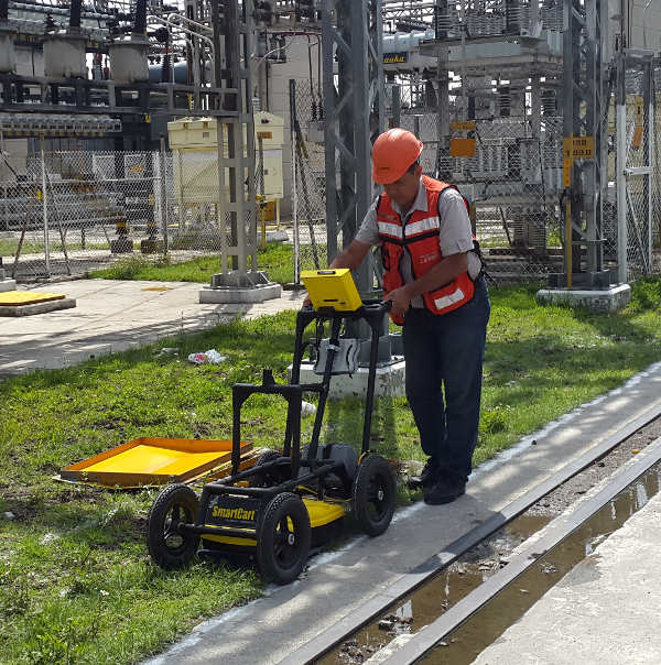
Our Survey Process
Our methodology ensures reliable results and quality deliverables:
- Planning & Antenna Selection
We analyze project objectives and select the appropriate antenna based on required depth and resolution.
- Field Survey
Systematic coverage of the area with GPR equipment, recording the exact position of each survey line.
- Data Processing
Application of filters, gain corrections, and migration to enhance radargram quality and highlight targets of interest.
- Expert Interpretation
Our specialists analyze the radargrams, identifying pipes, cables, geological layers, and anomalies. This stage requires experience and geological context.
- Report Delivery
CAD plans with XY location and depth of detected elements, interpreted radargrams, and technical report with conclusions.
Our Antennas (Transient Technologies)
We have the full range of antennas to match any depth requirement:
| Antenna | Depth Range | Typical Application |
|---|---|---|
| 70 MHz | Up to 30 m (100 ft) | Deep geology, bedrock mapping |
| 125 MHz | Up to 15 m (50 ft) | Geotechnical, stratigraphy |
| 300 MHz | 5-8 m (15-25 ft) | Utility detection (most versatile) |
| 600 MHz | 3-5 m (10-15 ft) | High resolution, shallow utilities |
| 900 MHz | 2-3 m (6-10 ft) | Concrete inspection, pavements |
| 1500-2000 MHz | 0.5-1 m (1.5-3 ft) | Ultra resolution, thin slabs |
What We Deliver
At the end of the survey, you receive a complete package ready for your project:
- Processed & Interpreted Radargrams - Subsurface images with identified elements
- CAD Plans (DWG/DXF) - XY location and depth of detected utilities and objects
- Technical Report - Methodology, equipment used, results, conclusions, and recommendations
- Field Photography - Documentation of the survey
- Original Digital Files - For future reference or reprocessing
📄 Download a Sample Report
See the quality of our deliverables before you hire:
Download Sample Report (PDF)GPR Limitations
For an honest service, it's important to know where GPR has difficulties:
- Wet clay soils: Especially expansive clays (montmorillonites), which absorb the signal rapidly.
- Saltwater: Penetration is very limited in coastal areas with saline saturation.
- Highly conductive soils: Drastically reduce exploration depth.
Optimal conditions: Sandy, dry soils with low clay content. In these conditions, GPR delivers excellent results.
Why Choose Cartomex for GPR?
- 20+ Years Experience: Thousands of GPR surveys across Mexico since 2003.
- Expert Interpretation: We don't just collect data—our specialists interpret it in geological context.
- State-of-the-Art Equipment: Latest Transient Technologies (VIY) GPR systems with full antenna range.
- Bilingual Reports: English or Spanish documentation for international projects.
- Fast Turnaround: Proposal within 1 hour. Typical report delivery in 3-5 days.
- Mexico Coverage: We operate nationwide and across Latin America.
Frequently Asked Questions
What is GPR and how does it work?
Ground Penetrating Radar (GPR) is a geophysical technique that emits electromagnetic waves into the ground. When these waves encounter a change in material (pipe, rock layer, void), part of the energy reflects back and is captured by the equipment. By analyzing these reflections, we create an image of the subsurface.
How deep can GPR detect?
Depth depends on the antenna used and soil conditions. Low-frequency antennas (70 MHz) can reach up to 30 meters (100 ft) in dry soils. For utility detection, we typically use 300-900 MHz antennas that reach 3-8 meters (10-25 ft) with excellent resolution.
Can GPR detect plastic (PVC) pipes?
Yes, GPR detects any material with different electrical properties from the surrounding soil, including PVC, concrete, metal, and plastic. This is an advantage over radio detection which only finds metallic utilities.
In what soil conditions does GPR NOT work well?
GPR has limitations in highly conductive materials like wet clay soils (especially expansive clays/montmorillonites) and areas with saltwater. The signal attenuates rapidly in these conditions. Dry, sandy soils provide optimal results.
How long does a GPR survey take?
Field work is fast—we can typically cover several hundred linear meters per day. Processing and interpretation takes 1-3 additional days depending on complexity. We deliver proposals within 1 hour of your request.
Do you work with US-based companies on projects in Mexico?
Absolutely. We regularly serve US engineering firms, construction companies, and consultants who have projects in Mexico. We provide bilingual reports and can coordinate with your local team.