Electrical Resistivity Tomography (ERT): Mapping the Subsurface with Precision
Over 20 years online have taught us something: quotes are needed fast. That's why we deliver a proposal within 1 hour. Use our service forms for best results.
What is Electrical Resistivity Tomography?
Electrical Resistivity Tomography (ERT), also known as resistivity imaging, is an advanced geophysical technique that creates detailed 2D and 3D images of subsurface structures by measuring how electrical current flows through the ground.
Different materials have characteristic resistivity values: clay is conductive (low resistivity), dry sand and rock are resistive (high resistivity), and water-saturated zones show intermediate to low values. By analyzing these patterns, we can interpret geology, locate aquifers, detect faults, and identify contamination.
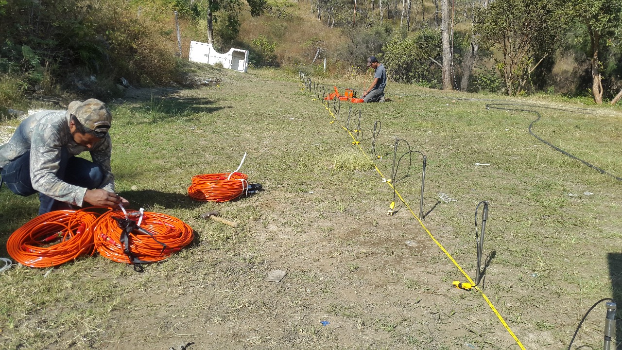
How ERT Works
- Field Measurement
Electrodes are placed along a line at regular intervals. Current is injected through two electrodes while voltage is measured at others, providing "apparent resistivity" data.
- Data Inversion
Specialized software uses mathematical algorithms (least squares, finite elements) to convert apparent resistivity into a model of "true resistivity" at depth.
- Expert Interpretation
Our geophysicists interpret the resistivity model using geological knowledge to identify materials, structures, and anomalies relevant to your project.
Key Applications
Geotechnical Engineering
- Fault Detection: Locate and characterize geological faults critical for foundation design
- Landslide Analysis: Map slip surfaces and colluvial deposit thickness
- Bedrock Mapping: Determine depth to rock and weathering profiles
- Cavity Detection: Identify voids, caves, and sinkholes in karst terrain
Hydrogeology
- Aquifer Location: Map groundwater zones for well placement
- Saltwater Intrusion: Delineate fresh/saline water boundaries in coastal areas
- Dam Seepage: Monitor infiltration and detect leakage paths
Environmental Studies
- Contamination Mapping: Delineate hydrocarbon plumes and leachate
- Landfill Characterization: Assess waste thickness and moisture distribution
Electrode Arrays We Use
| Array | Best For | Characteristics |
|---|---|---|
| Schlumberger | Horizontal layers, faults | Our preferred array - excellent resolution for most applications |
| Dipole-Dipole | Vertical structures, cavities | High lateral resolution, good for discrete targets |
| Wenner | Noisy environments | Strong signal, resistant to electrical interference |
Deliverables
- 2D Resistivity Profiles - Color-coded cross-sections with depth scale
- Geological Interpretation - Materials and structures identified
- Technical Report - Methodology, equipment, results, recommendations
- Digital Data Files - For integration with your engineering software
Why Choose Cartomex for ERT?
- LanGeo Equipment: We use professional-grade resistivity meters from LanGeo (Russia)
- Calibration with Boreholes: We validate geophysical models with direct drilling data when available
- Combined Methods: We integrate ERT with seismic, GPR, or VES for comprehensive site characterization
- Fast Turnaround: Proposal within 1 hour, typical delivery 5-7 days
Frequently Asked Questions
What is Electrical Resistivity Tomography?
ERT is a geophysical method that measures how easily electrical current flows through the ground. Different materials (clay, sand, rock, water) have different resistivities, allowing us to create a detailed 2D or 3D image of subsurface structures.
How deep can ERT surveys reach?
Depth depends on the electrode array length. Typically, we can image from 10 to 100+ meters deep. Longer arrays achieve greater depths but with reduced resolution. We design arrays based on your specific project objectives.
What's the difference between ERT and GPR?
GPR provides higher resolution for shallow targets (utilities, concrete) but is limited in clay soils. ERT works well in all soil types and reaches greater depths, making it ideal for geological and hydrogeological studies. We often combine both methods.
Can ERT detect water?
Yes, ERT is excellent for groundwater studies. Water-saturated zones appear as low resistivity anomalies. We can map aquifers, water tables, and even distinguish between fresh and saline water.